


- About us
- Our Services
- New included books
- Newspapers and Periodicals
- E-Library
- E-Service
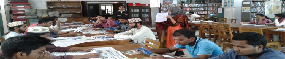
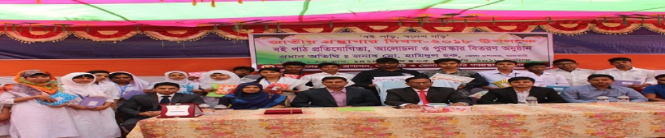
- Gallery
- Forms
-
Other Offices
Ministry/Department
Divisional Office/District Office
- Contact
- Opinion
- About us
- Our Services
-
New included books
List of new books
Pictures of the new book
-
Newspapers and Periodicals
List of daily newspapers
List of Periodicals
-
E-Library
E-Book Usage Guidelines
Directorate of Public Libraries e-Library
E-Library Download access
-
E-Service
National E-Service
Mobile App
গ্রন্থাগার সংক্রান্ত তথ্য সংবাদ
-
Gallery
Photogallery
Video gallery
-
Forms
About Private Libraries
Other Forms Required
Members/Contest Related
-
Other Offices
Ministry/Department
Divisional Office/District Office
Upazila Office/Special Public Library
-
Contact
ডাকযোগে যোগাযোগ
Online Communication
-
Opinion
Comments, suggestions or complaints (Facebook Messenger)
District Government Public Library, Jhalkathi
Jhalakathi at a glance
History of Jhalkathi District
It is not known exactly when the Jhalakathi land was settled, but the name suggests that it was the people of the Kaivarta fisherman community who started the first plantation here from very ancient times. Kaivart fishermen were called Jhalos and their neighborhoods were called Jhaloparas. Many believe that the name Jhalakathi originates from Jhalpara.
Poet Vijaygupta Mansamangal also referred to the fishermen community as Jhalo. When the local people got into trouble with the fishermen of Mehdipur, they cut down the Katabakhari forests on both banks of the Basanda and Dhanhata canals and settled them. In Jhalakathi port, most of the citizens were formerly Kaivardas or fishermen.
On the west bank of the present day Jhalkathi, the fishermen used to clear the forest and build their dwellings: Jhalkathi is named after the corruption of fisherman + stick = net + stick. The name Jhalkathi originates from this fisherman and forest stick. Similarly Chandkathi, Krishnakathi, Charkathi, Vinayakathi etc. Which is contained in Svarmanpakathi Parimatma. The names of Jhalkathi and Naikathi are also mentioned in a copper plate of Vishwaramnapopa Sen. From this, the name Jhalkathi got its support from the fishermen.
The ancient name of Jhalkathi district was Maharajganj. Jhalkathi is a small district with an area of 758.06 square kilometers with green fields, trees, rivers, streams, canals and streams. Since 1984, this district has been a shining star on the map of Bangladesh. When the name of this district is uttered, the hearts of the people of the whole country float like the moon in the sky, the Dhansindi river in the famous poem of poet Jibanand Das Abar Asib Phre. This district has a glorious history that shines like a brilliant sculptor. Although this district is one of the coastal districts of Bangladesh, it has a unique role in all aspects.
Statistics
|
Upazila Name |
Volume (sq km) |
Number of Village |
Population |
Literacy rate |
Total Land Area (Acres) |
Union/Municipal Land Office No |
Number of hospitals |
|||
|
Women |
Man |
Total |
Agriculture (Acres) |
Non-agricultural (acres) |
||||||
|
Jhalokathi Sadar |
159.45 |
190 |
110880 |
105464 |
216348 |
68.8% |
29316 |
25298 |
11 |
2 |
|
Nalcity |
231.42 |
138 |
101425 |
92131 |
193556 |
67.2% |
31635 |
24313 |
11 |
1 |
|
Rajapur |
164.58 |
75 |
77461 |
71033 |
148494 |
63.9% |
21563 |
17270 |
6 |
1 |
|
Kathalia |
151.29 |
52 |
63756 |
60515 |
124271 |
65.3% |
22428 |
14953 |
6 |
1 |
|
Total |
706.76 |
455 |
353522 |
329147 |
382669 |
66.7% |
104942 |
82434 |
34 |
5 |
|
Upazila Name |
Number of Health and Family Welfare Centres |
Number of community clinics |
Number of primary schools |
Number of Secondary schools |
Number of College |
Number of Mosque |
Number of temples |
|||
|
Goverment |
Register |
Goverment |
Non-Goverment |
Goverment |
Non-Goverment |
|||||
|
Jhalokathi Sadar |
10 |
27 |
161 |
- |
2 |
51 |
2 |
5 |
537 |
72 |
|
Nalcity |
10 |
26 |
166 |
- |
- |
49 |
- |
8 |
960 |
28 |
|
Rajapur |
5 |
19 |
122 |
- |
- |
54 |
- |
6 |
510 |
26 |
|
Kathalia |
5 |
17 |
132 |
- |
- |
38 |
- |
8 |
485 |
199 |
|
Total |
30 |
89 |
581 |
- |
2 |
192 |
2 |
27 |
2528 |
245 |
|
Upazila Name |
Number of cyclone shelters |
Number of food warehouses |
Number of markets |
Number of watersheds |
Amount of paved roads (km) |
Amount of unpaved roads (km) |
Number of Union Parishads |
Number of municipalities |
Number of ferries |
Number of attractions |
|
Jhalokathi Sadar |
10 |
5 |
23 |
1 |
267 |
997 |
10 |
1 |
- |
7 |
|
Nolcity |
10 |
3 |
32 |
2 |
292 |
363 |
10 |
1 |
1 |
1 |
|
Rajapur |
13 |
2 |
31 |
1 |
259 |
816 |
6 |
- |
- |
3 |
|
Kathadlia |
12 |
3 |
15 |
- |
155 |
1012 |
6 |
- |
1 |
1 |
|
Total |
45 |
13 |
101 |
4 |
973 |
3188 |
32 |
2 |
2 |
12 |


Planning and Implementation: Cabinet Division, A2I, BCC, DoICT and BASIS
Technical Assistance:
![]()
Developed By: